Venice tram map
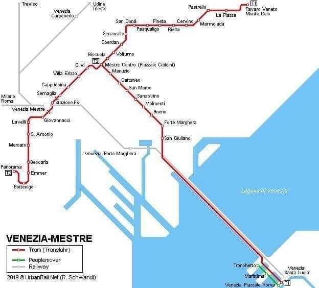
You can find on this page the Venice tram map to print and to download in PDF. The Venice trams map presents the network, zones, stations and different lines of the tramway of Venice in Italy.
Venice tramway map
The Venice tram map shows all the stations and lines of the Venice tramways. This tramway map of Venice will allow you to easily plan your routes in the trams of Venice in Italy. The Venice tram map is downloadable in PDF, printable and free.
The ACTV’s T1 Tramway, which entered service in September, 2015 and runs directly from the northern edge of downtown Mestre to Piazzale Roma on the edge of Venice car-free historic center. (See Venice tramway map) Venice tramway is convenient if you are staying at a hotel near the section of the T1 (red) line between the Piazzale Cialdini and Forte Marghera, which runs mostly along a major street called the Via San Marco.